Category:1799 maps of Norway
English: 1799 maps made in Norway or from Norway or showing history of Norway
Media in category "1799 maps of Norway"
The following 29 files are in this category, out of 29 total.
-
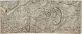
 Akershus amt nr 19 nord- Kart over Blaker Skandse med omliggende Terræn, 1799.jpg 26,894 × 11,151; 50.48 MB
-
 Akershus amt nr 19 sør- Kart over Blaker Skandse med omliggende Terræn, 1799.jpg 26,898 × 11,180; 51.7 MB
-
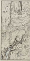
 Kristians amt nr 10- Kart over Gulbrand Dahlens Provstie og Fogderie, 1799 (cropped).jpg 1,821 × 1,699; 710 KB
-
 Kristians amt nr 10- Kart over Gulbrand Dahlens Provstie og Fogderie, 1799.jpg 3,471 × 5,688; 2.52 MB
-
 Kvadratmilkart Mil nr 154-nv-sv, 1799.jpg 7,303 × 14,538; 14.64 MB
-
 Kvadratmilkart Mil nr 154-nø-sø, 1799.jpg 7,370 × 14,506; 14.89 MB
-
 Kvadratmilkart Mil nr 164-nv-nø, 1799.jpg 13,274 × 7,220; 9.93 MB
-
 Kvadratmilkart Mil nr 164-sø, 1799.jpg 7,208 × 7,218; 7.07 MB
-
 Kvadratmilkart Mil nr 165-nv-sv, 1799.jpg 7,387 × 14,515; 15.25 MB
-
 Kvadratmilkart Mil nr 165-nø-sø, 1799.jpg 7,436 × 14,548; 16.49 MB
-
 Kvadratmilkart Mil nr 167-nv-sv, 1799.jpg 7,420 × 14,489; 14.48 MB
-
 Kvadratmilkart Mil nr 167-nø-sø, 1799.jpg 7,354 × 14,456; 11.35 MB
-
 Kvadratmilkart Mil nr 39-nø-sø, 1799.jpg 7,237 × 12,790; 16.73 MB
-
 Kvadratmilkart Mil nr 40-nv-sv, 1799.jpg 7,270 × 12,790; 16.73 MB
-
 Kvadratmilkart Mil nr 40-nø-sø, 1799.jpg 7,154 × 12,841; 15.36 MB
-
 Kvadratmilkart Mil nr 46-nv, 1799.jpg 6,883 × 6,944; 10.21 MB
-
 Kvadratmilkart Mil nr 46-nv-sv, 1799.jpg 7,137 × 14,456; 14.9 MB
-
 Kvadratmilkart Mil nr 46-nø-sø, 1799.jpg 7,137 × 14,289; 16.82 MB
-
 Kvadratmilkart Mil nr 47-nv-sv, 1799.jpg 7,286 × 14,355; 17.11 MB
-
 Kvadratmilkart Mil nr 47-nø-sø, 1799.jpg 7,270 × 14,456; 18.89 MB
-
 Kvadratmilkart Mil nr 53-nø-sø, 1799.jpg 7,136 × 14,289; 9.71 MB
-
 Kvadratmilkart Mil nr 54-nv-sv, 1799.jpg 7,070 × 14,106; 15.7 MB
-
 Kvadratmilkart Mil nr 54-nø-sø, 1799.jpg 7,054 × 14,156; 16.66 MB
-
 Sjøkart over Oslofjorden fra Oslo til Fredriksvern 1799 1.png 2,460 × 5,037; 23.59 MB
-
 Sjøkart over Oslofjorden fra Oslo til Fredriksvern 1799 2.png 2,503 × 4,938; 24.55 MB
-
 Smålenenes amt nr 97 nord- Plan Over Fæstningen Friderichstad (nord), 1799.jpg 15,039 × 7,613; 11.24 MB
-
 Smålenenes amt nr 97 sør- Plan Over Fæstningen Friderichstad (sør), 1799.jpg 15,005 × 7,465; 9.82 MB
-
 Smålenenes amt nr 98 nord- Carte over Friderichsteens Fæstning (nord), 1799.jpg 16,199 × 6,912; 13.19 MB
-
 Smålenenes amt nr 98 sør- Carte over Friderichsteens Fæstning (sør), 1799.jpg 16,299 × 6,999; 10.61 MB


.jpg)


,_1799.jpg)
,_1799.jpg)
,_1799.jpg)
,_1799.jpg)