Category:17th-century maps of Estonia
Media in category "17th-century maps of Estonia"
The following 27 files are in this category, out of 27 total.
-

-
 Beschryvinghe van Lyflandt.jpg 2,990 × 2,448; 3.9 MB
-
 Livonia sive Liefland.jpg 2,038 × 1,581; 4.83 MB
-
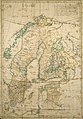
 Blaeu 1645 - Suecia Dania et Norvegia regna Europæ septentrionolia-2010-04-12.JPG 3,129 × 2,505; 1.83 MB
-
 Blaeu 1645 - Suecia Dania et Norvegia regna Europæ septentrionolia.jpg 3,619 × 3,012; 1.66 MB
-

-
 1662 Samogetia is Lithuania.jpg 2,908 × 1,772; 1.85 MB
-
 Atlas Van der Hagen-KW1049B10 029-LIVONIA Vulgo Lyetland.jpeg 5,500 × 4,318; 3.12 MB
-

-
 Gripenhielms generalkarta hel 1688.jpg 1,812 × 3,108; 1.94 MB
-

-

-
 Map - Special Collections University of Amsterdam - OTM- HB-KZL 31-07-26.tif 7,304 × 6,247; 130.54 MB
-
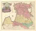
 17ct map with current borders of Belarus.jpg 3,968 × 3,363; 4.43 MB
-
 Blaeu 1645 - Livonia vulgo Lyefland.jpg 3,616 × 3,044; 1.13 MB
-
 Carte de la Livonie ou Lifland.jpg 2,198 × 1,985; 5.88 MB
-
 Cum privilegio.jpg 3,810 × 2,950; 5.66 MB
-
 Gripenhielms generalkarta hel 1688a.jpg 688 × 989; 338 KB
-
 LIVONIA vulgo Lyefland-Joan Blaeu, 1662.jpg 3,968 × 3,094; 4.27 MB
-
 Livoniae descriptio.jpg 1,044 × 817; 1.34 MB
-
 Nova totius Livoniæ accurata descriptio.jpg 4,188 × 3,209; 8.16 MB
-
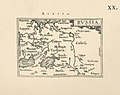 Ortelius.Russia.jpg 1,600 × 1,267; 401 KB
-
 Põltsamaa kaart.jpg 641 × 481; 265 KB
-

-
 Sarmatia Utraque Europaea et Asiatica.jpg 1,705 × 1,500; 564 KB
-

-
 Sw BalticPr 17cen.jpg 1,410 × 1,479; 1.4 MB
.jpg)


.jpg)


.2.(10).jpg)

_regna_Finniae_ducatum_Lapponiam,_Livoniam_Ingrianq(ue)_et_in_omnes_subiacentes_provincias_(8343083008).jpg)


.jpg)


