Category:17th-century maps of Southeast Asia
Subcategories
This category has the following 7 subcategories, out of 7 total.
C
M
T
V
Media in category "17th-century maps of Southeast Asia"
The following 51 files are in this category, out of 51 total.
-
 "Asia," by Giovanni Botero, an edition from 1659 southeast.jpg 800 × 600; 131 KB
-
 "Asiae Nova Descriptio," by P. Kaerius, 1614 - southeast.jpg 800 × 600; 149 KB
-

-
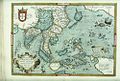
 Asia (1600) southeast.jpg 800 × 600; 147 KB
-
 Map of Asia (1600) south east.jpg 800 × 600; 166 KB
-
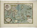
 Asia (1570) southeast (cropped).jpg 944 × 708; 204 KB
-
 Bodleian Libraries, Indiae Orientalis, insvlarvmqve adiacientivm typvs.jpg 1,000 × 675; 184 KB
-
 Map of India and the Maluku Islands by Abraham Ortelius.jpeg 1,562 × 1,186; 596 KB
-
 "Asiae Nova Descriptio," by P. Kaerius, 1614 - South Asia.jpg 800 × 600; 157 KB
-
 B26055951K - Mar di India.jpg 6,168 × 5,435; 7.72 MB
-

-
 Map of Asia (1628) South east.jpg 800 × 600; 156 KB
-
 B26056104B - India orientalis.jpg 4,562 × 3,594; 5.38 MB
-
 Map of India by Gerard Mercator.jpg 900 × 697; 85 KB
-
 Atlas ou Representation du Monde Universel t. 2. 1633 (110102987).jpg 17,129 × 12,037; 34.61 MB
-

-

-
 India quae Orientalis dicitur et Insulae Adiacentes.jpg 13,146 × 10,839; 25.56 MB
-
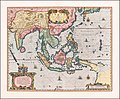
 Map of Asia from 1641.jpg 2,970 × 2,062; 1.46 MB
-
 A-3-37-09-India.jpg 3,000 × 2,283; 924 KB
-

-

-
 B26055973D - A new map of East India.jpg 6,768 × 5,302; 8.89 MB
-
-
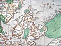
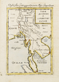
 Map of ancient Southeast Asia, 1683.jpg 725 × 1,078; 165 KB
-
 Map of eastern Indonesia, 1683.jpg 725 × 1,078; 161 KB
-
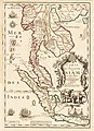
 Map of South and Southeast Asia, 1683.jpg 652 × 989; 252 KB
-
 Map of South and Southeast Asia, 1683b.jpg 725 × 1,078; 170 KB
-
 Map of Southeast Asia, 1683.jpg 725 × 1,078; 159 KB
-
 Map of Southeast Asia, 1683b.jpg 725 × 1,078; 167 KB
-
 Map of western Indonesia, 1683.jpg 725 × 1,078; 165 KB
-
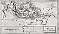
 Southeast Asia 1684.png 1,415 × 1,960; 4.06 MB
-
 Carte du royaume de Siam et des pays circonvoisins 1686.jpg 2,831 × 3,912; 2.34 MB
-
 Peta Asia 1686.jpg 1,080 × 1,492; 479 KB
-
 Atlante Veneto Volume 1 065.jpg 6,722 × 9,728; 6.79 MB
-
 Philipine Cambodge 1696 Nicolas de Fer 04984.jpg 3,264 × 4,912; 5.08 MB
-
 Dampier, Map of the East Indies.jpg 1,429 × 829; 360 KB
-
-

-
 Golfe du Siam, Cochinchine et Bornéo - John Thornton - btv1b7200767z (1 of 2).jpg 10,101 × 11,956; 12.26 MB
-
 India Orientalis - btv1b531793321 (1 of 2).jpg 1,482 × 1,282; 388 KB
-

-
 B26055971B - Isole dell'India, cioeÌ€ le Molucche, le Filippine e della Sonda.jpg 6,738 × 5,325; 8.75 MB
-
 CasparSchmalkalden AsiaMap.jpg 954 × 622; 234 KB
-
-
 Indochina1606(India Orientalis).jpg 1,654 × 1,965; 3.64 MB
-
 Map of Guam and the Mariannas, 1683.jpg 725 × 1,078; 187 KB
-
 Map of New Guinea, 1685.jpg 666 × 900; 387 KB
-
 Map of the Philippines, 1683.jpg 725 × 1,078; 167 KB
-
 Map of the Solomon Islands, 1685.jpg 606 × 900; 421 KB
-
 Orientalis Idiae.jpg 2,069 × 1,718; 1.37 MB


.jpg)
_southeast.jpg)
_south_east.jpg)
_southeast_(cropped).jpg)


.jpg)
_South_east.jpg)


.jpg)
,_NG-501-73.jpg)
.jpg)


.jpg)
_-_btv1b52511195b_(59_of_85).jpg)

,_Philippines,_and_other_South_East_Asia_Countries_by_Dutch_%E8%8D%B7%E8%98%AD%E4%BA%BA%E6%89%80%E7%B9%AA%E7%A6%8F%E7%88%BE%E6%91%A9%E6%B2%99-%E8%87%BA%E7%81%A3,_%E8%8F%B2%E5%BE%8B%E8%B3%93,_%E8%88%87%E6%9D%B1%E5%8D%97%E4%BA%9E.jpg)


.jpg)
.jpg)


.jpg)


