Category:17th-century maps of Sumatra
Media in category "17th-century maps of Sumatra"
The following 26 files are in this category, out of 26 total.
-
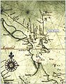
 Map of the coast of Atjeh from ca. 1602.jpg 2,680 × 2,001; 824 KB
-
 Map of the coast of Sumatra near Ticu.jpg 2,680 × 2,001; 721 KB
-

-
 Bontekoe and his crew in Sumatra in 1618.jpg 2,048 × 1,430; 830 KB
-
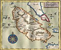
 Hessel Gerritsz, Map of Sumatra showing Pedra Branca (1620).jpg 497 × 628; 105 KB
-
 AMH-4612-NA Map of the settlement at Atjeh.jpg 2,400 × 1,921; 914 KB
-
 Map of Sumatra 1648.jpg 2,713 × 2,243; 891 KB
-
 AMH-5525-NA Map of Sumatra and the Malacca Straits.jpg 1,826 × 2,400; 900 KB
-
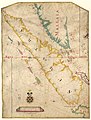
 AMH-5146-NA Map of the southern coast of Sumatra.jpg 2,400 × 2,108; 975 KB
-
 Océan Indien - 1655 by Joan Blaeuw - btv1b7200852v (1 of 2).jpg 12,001 × 9,074; 19.9 MB
-
 AMH-6131-NA Map of the city of Atjeh.jpg 2,400 × 1,552; 672 KB
-
 Océan Indien, Australie-Occidentale... Blaeu Joan.jpg 1,309 × 1,054; 393 KB
-
 AMH-5523-NA Map of Sumatra and the Malacca Straits.jpg 2,149 × 2,400; 929 KB
-
 1685 9 Sumatra Blaeu ms Gallica.jpg 4,963 × 5,900; 7.43 MB
-
 Carte du royaume de Siam et des pays circonvoisins 1686.jpg 2,831 × 3,912; 2.34 MB
-
 Océan Indien - 1687 by Joan Blaeu - btv1b5905757d (1 of 2).jpg 11,736 × 9,344; 14.96 MB
-
 Océan Indien - 1691 t'Amsterdam by Joan Blaeu - btv1b5905758t (1 of 2).jpg 11,456 × 9,240; 15.92 MB
-
 Sumatra, détroit de Malacca et détroit de la Sonde - John Thornton - btv1b59057100 (1 of 2).jpg 8,762 × 11,528; 14.61 MB
-
 AMH-4618-NA Map of the Lampon Samanca fort.jpg 2,400 × 1,682; 519 KB
-
 AMH-5138-NA Chart of the northern coast of Sumatra and Poeloe Weij.jpg 2,400 × 1,737; 626 KB
-
 AMH-5139-NA Map of the North coast of Sumatra and Poeloe Weij.jpg 2,400 × 1,686; 621 KB
-
 Mao Kun map - Langkawi, Kedah, Penang with Sumatra.png 1,185 × 1,659; 938 KB
-
 Mao Kun map - Sumatra & Thailand.JPG 1,136 × 1,616; 507 KB
-
 Sumatrae et insularum locorumque nonnullorum circumiacentium tabula noua - CBT 6618061.jpg 5,888 × 4,738; 6.18 MB
-
 Carte française de Sumatra - btv1b72008464 (1 of 2).jpg 10,726 × 13,719; 18.76 MB
-
 India quae Orientalis dicitur et insulae adiacentes - btv1b525051494 (2 of 4).jpg 9,744 × 7,897; 8.41 MB


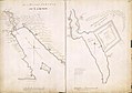
.jpg)


.jpg)


.jpg)
.jpg)
.jpg)


.jpg)
.jpg)