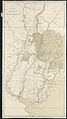
Category:1800s maps of Brazil
Countries of the Americas: Argentina · The Bahamas · Brazil · Canada · Chile · Colombia · Cuba · Ecuador · Mexico · Panama · Paraguay · United States of America · Uruguay · Venezuela
Other areas: Puerto Rico
Other areas: Puerto Rico
Media in category "1800s maps of Brazil"
The following 6 files are in this category, out of 6 total.
-

-
 Mappa Geographico da Capitania de Matto Grosso, Acervo do Museu Paulista da USP.jpg 7,216 × 5,412; 16.71 MB
-
 Matto Grosso - 1 (2), Acervo do Museu Paulista da USP.jpg 5,412 × 7,216; 22.39 MB
-

-

-
 A map of part of the Viceroyalty of Buenos Ayres (4586557183).jpg 1,126 × 2,000; 1.98 MB
.jpg)

,_Acervo_do_Museu_Paulista_da_USP.jpg)
.jpg)

.jpg)