Category:1810s maps of Eastern Europe
| 19th-century maps of Eastern Europe: ← 1800s 1810s 1820s 1830s 1840s 1850s 1860s 1870s 1880s 1890s → |
Subcategories
This category has only the following subcategory.
M
Media in category "1810s maps of Eastern Europe"
The following 9 files are in this category, out of 9 total.
-
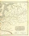
 Poland in 1810 (Duchy of Warsaw).jpg 1,200 × 1,023; 137 KB
-
 Carte du Théâtre de la Guerre en Russie et en Allemagne pendant 1812 et 1813.tif 9,009 × 6,172; 97.04 MB
-
 Turkey, in Europe and Hungary, from the best authorities. NYPL1404027.tiff 6,300 × 5,248; 94.61 MB
-
-
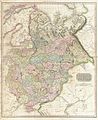 1818 Pinkerton Map of Russia in Europe - Geographicus - RussiaEurope-pinkerton-1818.jpg 4,090 × 5,000; 6.37 MB
-

-
 A map exhibiting the retreat of the French Army (BM 1918,0423.62).jpg 1,749 × 2,500; 953 KB
-

-
 Russland BV023379535.jpg 9,009 × 6,172; 6.77 MB
.jpg)
_(With_portraits.)%27_(11005099443).jpg)

_With_numerous_maps_and_notes%27_(11110565915).jpg)
.jpg)
.jpg)
