Category:1811 maps of Europe
Temperate regions: North America · South America · Africa · Europe · Asia · Oceania – Polar regions: – Other regions:
English: 1811 maps of Europe
Español: Mapas de Europa en 1811
Suomi: Euroopan kartat vuodelta 1811
Română: Hărți ale Europei din 1811
Subcategories
This category has the following 13 subcategories, out of 13 total.
.
A
F
G
I
N
- 1811 maps of Norway (7 F)
P
- 1811 maps of Poland (empty)
R
- 1811 maps of Russia (5 F)
S
T
U
- 1811 maps of the United Kingdom (21 F)
Media in category "1811 maps of Europe"
The following 5 files are in this category, out of 5 total.
-
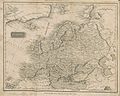 (1811) MAP OF EUROPE.jpg 3,133 × 2,511; 1.93 MB
-
 (1811) MAP OF SWEDEN, NORWAY ect.jpg 3,181 × 2,518; 2 MB
-
 Carte de l'Empire Français Divisé en 133 Départemens (Bonissel, 1811).jpg 12,209 × 9,289; 16.27 MB
-

-

_MAP_OF_EUROPE.jpg)
_MAP_OF_SWEDEN,_NORWAY_ect.jpg)
.jpg)

.jpg)