Category:1814 maps of Louisiana
States of the United States: Iowa · Louisiana · Maryland · Massachusetts · Missouri · Ohio · Pennsylvania
| 1813 1814 1815 1816 1817 1818 1819 |
Media in category "1814 maps of Louisiana"
The following 7 files are in this category, out of 7 total.
-
 1814 Thomson Map of Texas, Mexico ^ Louisiana - Geographicus - SpanishNorthAmer-t-1814.jpg 4,000 × 3,325; 2.98 MB
-
 Lake Borgne 1814.png 363 × 700; 144 KB
-
 Louisiana. LOC 2002624016.jpg 6,083 × 4,970; 4.12 MB
-
 Louisiana. LOC 2002624016.tif 6,083 × 4,970; 86.5 MB
-
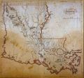 LouisianaMap1814.jpg 1,404 × 1,316; 615 KB
-
 Plan of the English Turn, 1814.png 1,536 × 712; 697 KB
-


