Category:1820 maps of Lithuania
Countries of Europe: France‡ · Germany · Latvia · Lithuania · Norway · Russia‡ · Spain‡
‡: partly located in Europe
‡: partly located in Europe
| 1820 |
Media in category "1820 maps of Lithuania"
The following 11 files are in this category, out of 11 total.
-
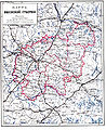
 1820 Виленская Губерния.jpg 4,908 × 4,739; 20.13 MB
-
 1820 Гродненская Губерния и Белостокская Область.jpg 4,764 × 4,706; 20.16 MB
-
 1820 Царство Польское.jpg 4,840 × 4,744; 19.79 MB
-
 Brockhaus and Efron Encyclopedic Dictionary b11 318-0.jpg 2,552 × 3,121; 3.12 MB
-
 Congress Poland 1820.jpg 4,840 × 4,744; 4.52 MB
-
 Congress Poland 1820.tif 4,840 × 4,744; 40.23 MB
-
 Courland governorate 1820.jpg 4,873 × 4,746; 4.41 MB
-
-

-

-
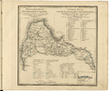
 Grobiņas apriņķis 1820.jpg 653 × 1,435; 452 KB


