Category:1824 maps
| ← · 1820 · 1821 · 1822 · 1823 · 1824 · 1825 · 1826 · 1827 · 1828 · 1829 · → |
Deutsch: Karten mit Bezug zum Jahr 1824
English: Maps related to the year 1824
Español: Mapas relativos al año 1824
Français : Cartes concernant l’an 1824
Русский: Карты 1824 года
Subcategories
This category has the following 6 subcategories, out of 6 total.
Media in category "1824 maps"
The following 58 files are in this category, out of 58 total.
-
Antoine-Remy Frémin, Carte du midi de la Judée ou Terre - Sainte (FL37128423 3906589).jpg 4,742 × 3,248; 6.24 MB
-
Bridgeport 1824.png 3,450 × 2,762; 6.04 MB
-
Carte de la Palestine dressée pour l'usage des Collèges 1824 (FL36012565 3911564).jpg 11,332 × 8,707; 146.76 MB
-
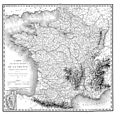
Carte des routes royales de la France - 1824.jpg 7,261 × 6,928; 14.2 MB
-
China LOC 2006629353.tif 5,291 × 4,059; 61.44 MB
-
Egypt (FL37119184 3896421).jpg 2,435 × 3,067; 3.23 MB
-
Figure of the Earth, 1824.jpg 1,852 × 1,913; 1.25 MB
-
Geographical conversation cards - (states of the United States) LOC 2002620534.jpg 16,225 × 10,517; 15.37 MB
-
Geograpy and supposed Astronomy of Joshua's miracle (FL45612649 3959053).jpg 3,183 × 2,083; 2.75 MB
-
Joseph Franz Kaiser, Novii Plan Moskvi (FL169614379 2370004).jpg 15,657 × 12,799; 236.09 MB
-
Karte Louisiana 1824 9153.jpg 3,210 × 2,946; 2.23 MB
-
Louis Vivien de Saint-Martin, Carte des iles Britanniques 01-sheet-1 (FL37660906 2582385).jpg 13,229 × 10,030; 174.16 MB
-
Louis Vivien de Saint-Martin, Carte des iles Britanniques 02-sheet-2 (FL37660911 2582385).jpg 13,901 × 10,410; 212.71 MB
-
Map of Bridgeport, 1824.jpg 2,370 × 1,918; 367 KB
-
Map of Lancaster County, Pennsylvania LOC 2012592189.tif 14,284 × 11,020; 450.35 MB
-
Map of the district of Delaware in Ohio (4231299165).jpg 1,518 × 2,000; 3.04 MB
-
Map of the state of New York LOC 00554823.tif 6,617 × 5,195; 98.35 MB
-
Map of the United States, constructed from the latest authorities (7557426230).jpg 6,033 × 4,702; 29.56 MB
-
Mapa-brasil-1824.png 2,339 × 2,184; 348 KB
-
Palaestina Inset. Das Judische land zur zeit des Kaisers Augustus (FL32715112 3877134).jpg 7,078 × 9,950; 97.2 MB
-
Pierre M. Lapie, Palestine (FL35077118 3887317).jpg 6,253 × 8,479; 72.51 MB
-
Pierre M. Lapie, Syrie et Égypte anciennes (FL35077145 3887320).jpg 6,479 × 8,316; 69.51 MB
-
Special-Karte des Fuerstenthums Lippe - Ausschnitt Hoevelhof.jpg 739 × 482; 111 KB
-
The mount of Olives (FL45612636 3959054).jpg 2,859 × 2,079; 2.62 MB
-
Thomas Tucker Smiley, Palestine, or The Holy Land (FL36587202 3916621).jpg 2,884 × 4,315; 7.15 MB
-
Thomas Tucker Smiley, The Eastern countries, as mentioned by Moses (FL36587224 3916625).jpg 2,872 × 2,283; 3.11 MB
-
WP Stadtplan Lübeck 1824.jpg 6,627 × 5,065; 19.95 MB


