Category:1825 maps of the United States
Subcategories
This category has the following 3 subcategories, out of 3 total.
O
- 1825 maps of Ohio (2 F)
S
- 1825 maps of South Carolina (54 F)
Media in category "1825 maps of the United States"
The following 26 files are in this category, out of 26 total.
-

-

-

-

-

-

-

-

-

-

-

-
 Canals USA 1825.png 960 × 930; 195 KB
-
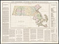 Carte géographique, statistique et historique de Massachusetts (2674140773).jpg 2,000 × 1,520; 2.72 MB
-
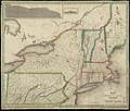
 Map of Connecticut River from Barnet Vermont to Hartford Con. (2674436885).jpg 2,000 × 1,362; 2.41 MB
-
 Map of the country contiguous to the Chesapeake & Delaware Canal LOC 80695659.jpg 3,217 × 2,560; 1.31 MB
-
 Map of the country contiguous to the Chesapeake & Delaware Canal LOC 80695659.tif 3,217 × 2,560; 23.56 MB
-
-
 Map of the surveyed part of the territory of Michigan 1825.jpg 8,298 × 12,772; 27.75 MB
-
 Map of the United States - intended chiefly to exhibit the Post Roads & distances. LOC 98685522.jpg 18,609 × 14,382; 48.29 MB
-
 Mills1825SE 250.gif 247 × 138; 6 KB
-
 Map of the United States of North America (NYPL b14036789-434033).jpg 10,262 × 10,085; 14.96 MB
-
-
 Tanesse New-Orleans Map 1825 printing.jpg 1,146 × 723; 557 KB
-
 The traveller's directory through the United States. NYPL484178.tiff 2,790 × 2,140; 17.09 MB
-
-
 Vereinigte Staaten von Nord-America (7557426384).jpg 2,048 × 1,569; 762 KB
_(14595231840).jpg)
_(14595239410).jpg)
_(14595282549).jpg)
_(14595313028).jpg)
_(14595427067).jpg)
_(14595432147).jpg)
_(14595435987).jpg)
_(14595450017).jpg)
_(14758938966).jpg)
_(14781959365).jpg)

.jpg)
.jpg)

.jpg)


.jpg)

.jpg)