Category:1830s maps of Berlin
|
Federal states of Germany: |
Media in category "1830s maps of Berlin"
The following 10 files are in this category, out of 10 total.
-
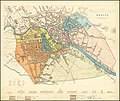
 Berlin 1833.jpg 6,336 × 5,075; 3.88 MB
-
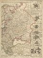
 Natorff Berlin 1831.jpg 5,309 × 4,590; 5.57 MB
-
 Reymann Neuester Grundriss von Berlin 1832.jpg 13,431 × 10,139; 31.08 MB
-
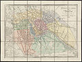
 1833 map of Berlin.jpg 9,443 × 7,968; 14.83 MB
-
 Reymann Neuester Grundriss von Berlin 1835.jpg 7,814 × 5,843; 12.48 MB
-
 Urmesstischblatt 3445 (Spandau) um 1835.jpg 5,200 × 5,196; 15.83 MB
-
 Europa - no-nb krt 01012.jpg 8,082 × 10,800; 26.16 MB
-
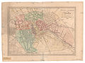
 Gross Plan von Berlin 1837.jpg 1,276 × 925; 578 KB
-
 Nonnendamm auf Urmesstischblatt um1835.jpg 4,500 × 1,864; 3.95 MB
-
 Urmesstischblatt 3445 (Spandau) um 1835 (auf Stresow).jpg 1,056 × 900; 669 KB


_um_1835.jpg)


_um_1835_(auf_Stresow).jpg)