Category:1833 maps of the United States
Subcategories
This category has the following 4 subcategories, out of 4 total.
Media in category "1833 maps of the United States"
The following 17 files are in this category, out of 17 total.
-
 1833 Eagle Map of the U.S..JPG 1,744 × 1,384; 1.58 MB
-
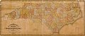 1833 Map of North Carolina.jpg 6,437 × 2,722; 3.05 MB
-

-

-
 Eagle Map of the United States Engraved For Rudiments of National Knowledge, edit.jpg 12,932 × 10,825; 129.1 MB
-
 Eagle Map of the United States Engraved For Rudiments of National Knowledge.jpg 12,932 × 10,825; 100.5 MB
-
-

-
-
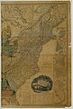
 New-York, N. Jersey and Pennsylvania (NYPL b15107783-434031).tiff 5,203 × 4,656; 69.32 MB
-
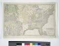
 United States (NYPL b15108566-434845).jpg 4,803 × 4,672; 5.49 MB
-
 United States (NYPL b15108613-434848).jpg 4,864 × 4,288; 5.14 MB
-

-
 The eagle map of the United States (10294052076).jpg 6,013 × 4,890; 7.79 MB
-
 The eagle map of the United States LOC 96688045.jpg 6,404 × 5,120; 6.57 MB
-
 The eagle map of the United States LOC 96688045.tif 6,404 × 5,120; 93.81 MB
-
 United States - by David H. Burr, New-York. NYPL434845.tiff 4,672 × 4,803; 64.21 MB


.jpg)


.jpg)
.jpg)
.jpg)
.jpg)
.jpg)
