Category:1839 maps of Ohio
States of the United States: Alabama · California · Connecticut · Florida · Georgia · Illinois · Indiana · Kentucky · Louisiana · Maine · Maryland · Massachusetts · Missouri · New Hampshire · New Jersey · New York · Ohio · Pennsylvania · Tennessee · Texas · Vermont
| 1833 1834 1836 1839 → |
Media in category "1839 maps of Ohio"
The following 7 files are in this category, out of 7 total.
-
-

-

-

-

-
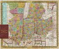
 Map of Ohio and Indiana WDL9600.png 1,377 × 1,024; 2.37 MB
-


.jpg)
.jpg)
.jpg)
.jpg)

