Category:1840 maps of Asia
Temperate regions: North America · South America · Africa · Europe · Asia · – Polar regions: – Other regions:
English: 1840 maps of Asia
Español: Mapas de Asia en 1840
Subcategories
This category has the following 5 subcategories, out of 5 total.
Media in category "1840 maps of Asia"
The following 16 files are in this category, out of 16 total.
-
 1840 map of Asia by the SDUK (cropped-Koueit or Grane).jpg 370 × 346; 25 KB
-
 1840 map of Asia by the SDUK.jpg 9,732 × 7,782; 12.72 MB
-
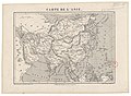
 Carte d'Asie - dressée par Pierre Tardieu - btv1b530931135.jpg 10,544 × 7,472; 10.62 MB
-
 Carte de l'Asie - dessiné et gravé par Ch. Avril ; lith. de Simon - btv1b8469872r.jpg 6,970 × 5,120; 5.5 MB
-
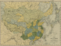 Carte de la Chine et des Etats-Tributaires.png 1,161 × 866; 2.28 MB
-
 China and Japan, John Nicaragua Dower (1844).jpg 7,297 × 5,945; 15.07 MB
-
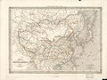
 Chinese empire and Japan. LOC 2006629414.jpg 5,783 × 4,879; 4.99 MB
-
 Chinese empire and Japan. LOC 2006629414.tif 5,783 × 4,879; 80.72 MB
-
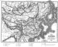
 Empires chinois et japonais LOC 2006629415.jpg 6,400 × 4,822; 5.51 MB
-
 Empires chinois et japonais LOC 2006629415.tif 6,400 × 4,822; 88.29 MB
-
 Evariste Huc carte voyage.png 903 × 734; 677 KB
-
 Henry Schenck Tanner, Asia (FL80721072 2617815).jpg 7,241 × 9,077; 70.16 MB
-

-
-
 Map of Tartary, Thibet, and China.png 2,951 × 2,262; 6.01 MB
-
 Qing China 1844.png 903 × 685; 1.37 MB
.jpg)


.jpg)


.jpg)
_-_nach_einem_japanischen_originale._LOC_2006458652.jpg)

