Category:1840s maps of Venezuela
Media in category "1840s maps of Venezuela"
The following 10 files are in this category, out of 10 total.
-
 1846 Carthagena detail map Colombie et Guyanes by Duvotenay BPL 11108.png 1,064 × 746; 1.75 MB
-
 1846 Maroa detail map Colombie et Guyanes by Duvotenay BPL 11108.png 1,064 × 746; 1.75 MB
-
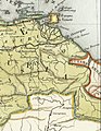
 1846 Medellin detail map Colombie et Guyanes by Duvotenay BPL 11108.png 1,064 × 746; 1.75 MB
-
 Meyer‘s Zeitungsatlas 017 – (Columbia) Neu-Granada, Ecuador und Venezuela.jpg 7,469 × 6,224; 14.44 MB
-
 Isla-de-Margarita-map-1840-Codazzi.jpg 854 × 605; 150 KB
-
-

-

-
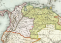
 Mapa de Venezuela 1840.jpg 638 × 450; 79 KB
-
 Plano topographico del puerto de La Ceiba - btv1b530882525.jpg 6,824 × 5,016; 4.12 MB


_Neu-Granada,_Ecuador_und_Venezuela.jpg)


