Category:1840s maps of the Caribbean
Media in category "1840s maps of the Caribbean"
The following 13 files are in this category, out of 13 total.
-

-
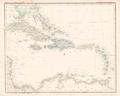
 Carte de la Mer des Antilles et du Golfe du Mexique.jpg 2,576 × 1,687; 1.21 MB
-

-
 Westindien Platt 1848.pdf 2,993 × 2,397; 442 KB
-

-
 Admiralty Chart No 1511 St Andrew Island, Published 1844.jpg 8,240 × 11,255; 20.13 MB
-
 Antilles ou Indes Occidentales (2674657483).jpg 2,000 × 1,492; 2.47 MB
-
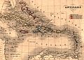 Carte antilles 1843.jpg 2,850 × 2,043; 2.59 MB
-

-
 Meyer‘s Zeitungsatlas 057 – Westindien und Mittelamerica.jpg 7,337 × 6,224; 13.18 MB
-
 West Indien und Mittel America (3120220075).jpg 2,000 × 1,656; 3.16 MB
-
 Westindische Inseln (3120220493).jpg 2,000 × 1,640; 2.9 MB
-
 Stieler-Stulpnagel Verein-Staaten von Nord-America, Mexico, Yucatan u. A. 1848 UTA.jpg 6,137 × 5,068; 9.77 MB


%27_(11026574454).jpg)

.jpg)

.jpg)

.jpg)
.jpg)
