Category:1845 maps of Norway
English: 1845 maps made in Norway or from Norway or showing history of Norway
Media in category "1845 maps of Norway"
The following 20 files are in this category, out of 20 total.
-

-
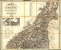
 General Kart over den Nordlige Deel af Kongeriget Norge (Noregr) - no-nb krt 00629.jpg 10,848 × 8,795; 23.71 MB
-
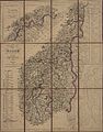
 General Kart over den nordlige Del af Kongeriget Norge 163, 1845.jpg 8,484 × 6,783; 9.61 MB
-
 Kart over det sydlige Norge 160-nord, 1845.jpg 9,227 × 7,554; 20.86 MB
-
 Kart over det sydlige Norge 160-sør, 1845.jpg 9,220 × 7,533; 25.02 MB
-
 Kart over det sydlige Norge, i ett blad - no-nb krt 00830.jpg 7,309 × 11,525; 26.15 MB
-
 Kart over det sydlige Norge, nordlig blad - no-nb krt 00713.jpg 9,667 × 8,028; 25.81 MB
-
 Kart over det sydlige Norge, nordlig blad - no-nb krt 00842.jpg 8,981 × 9,678; 28.84 MB
-
 Kart over det sydlige Norge, sydlig blad - no-nb krt 00555.jpg 7,785 × 6,463; 25.15 MB
-
 Kart over det sydlige Norge, sydlig blad - no-nb krt 00714.jpg 8,518 × 6,939; 25.35 MB
-
 Kart over det sydlige Norge, sydlig blad - no-nb krt 00828.jpg 9,704 × 7,883; 25.2 MB
-
 Kart over en Deel Af Kjøbmand Heidekkers Løkke (52), 1845.jpg 5,965 × 3,743; 3.9 MB
-
 Kart over Kristians Amt (sør), 1845.jpg 10,394 × 6,165; 13.13 MB
-
 Kart over Norge til Brug ved Elementær-Underviisningen. - no-nb krt 00840.jpg 6,918 × 8,839; 18.53 MB
-
 Kart over Norge til Brug ved Elementær-Underviisningen. - no-nb krt 00841.jpg 6,963 × 9,090; 16.82 MB
-
 Kart over Norge til Brug ved Elementær-Underviisningen.jpg 7,504 × 9,500; 18.48 MB
-
 Kart over Norges kyst fra Smøla til Tromsø 1845.png 3,051 × 3,889; 23.66 MB
-
 Kristians amt 1845745 - utsnitt.jpg 2,008 × 1,852; 1.92 MB
-
 Sjøkart over kysten utenfor Finnmark, fra Sørøya til Nordkapp, fra 1845.png 2,919 × 4,229; 23.57 MB
-
 Søndre Trondhjems amt nr 82- Copi af Kart over Tronhjem, 1845.jpg 5,000 × 2,378; 1.25 MB
.jpg)
_-_no-nb_krt_00629.jpg)


,_1845.jpg)
,_1845.jpg)


