Category:1847 maps of Europe
Temperate regions: North America · South America · Africa · Europe · Asia · – Polar regions: – Other regions:
English: 1847 maps of Europe
Español: Mapas de Europa en 1847
Suomi: Euroopan kartat vuodelta 1847
Română: Hărți ale Europei din 1847
Subcategories
This category has the following 8 subcategories, out of 8 total.
.
F
- 1847 maps of France (17 F)
I
- 1847 maps of Italy (3 F)
N
- 1847 maps of Norway (10 F)
S
- 1847 maps of Spain (6 F)
- 1847 maps of Switzerland (empty)
U
Media in category "1847 maps of Europe"
The following 7 files are in this category, out of 7 total.
-
 360 of 'Dictionnaire de Géographie ancienne et moderne' (11027482525).jpg 1,632 × 2,636; 1.11 MB
-
 361 of 'Dictionnaire de Géographie ancienne et moderne' (11027547983).jpg 1,629 × 2,635; 947 KB
-
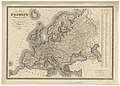 Carte générale d'Europe dressée - par Charle... - btv1b53093080b.jpg 9,416 × 6,752; 11.04 MB
-
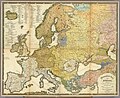
 Dänemark Karte 1847 Christian Gottfried Daniel Stein.jpg 8,855 × 11,555; 19.41 MB
-
 Ethnographic map of Europe in 1847 by Heinrich Berghaus.jpg 6,349 × 5,182; 7.69 MB
-

-
 Racial map of Europe German 1847.jpg 3,188 × 2,444; 1.89 MB
.jpg)
.jpg)


