Category:1848 maps of New York (state)
Media in category "1848 maps of New York (state)"
The following 12 files are in this category, out of 12 total.
-

-
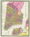 1848 Mitchell Map of New York City - Geographicus - NewYorkCity-mitchell-1848.jpg 2,826 × 3,500; 3.56 MB
-

-

-

-
 City of New-York - W. Kemble. NYPL434710.tiff 4,288 × 5,219; 64.03 MB
-

-
 Map of the Hudson River Rail Road from New York to Albany. LOC 98688681-1.jpg 45,354 × 5,691; 34.81 MB
-

-

-

-

_-_Geographicus_-_NewYork33Miles-colton-1848.jpg)


%27_(11141417955).jpg)
%27_(11141596486).jpg)
