Category:1849 maps of Texas
States of the United States: California · Florida · Georgia · Illinois · Mississippi · New York · Ohio · Pennsylvania · Texas
| ← 1840 1841 1844 1845 1846 1847 1849 |
Media in category "1849 maps of Texas"
The following 5 files are in this category, out of 5 total.
-
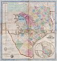 1849 De Cordova Map of the State of Texas.jpg 3,530 × 3,793; 4.32 MB
-
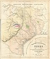
 Badeker Karte des Staates, Texas 1849 UTA.jpg 3,343 × 2,688; 2.46 MB
-
 Creuzbaur J. De Cordova's Map of Texas 1849 UTA.jpg 8,834 × 9,597; 19.36 MB
-

-
 Roemer Topographisch-Geognostiche Karte von Texas 1849 UTA.jpg 5,826 × 6,764; 11.85 MB


_of_Routes_from_San_Antonio_de_Bexar_to_El_Paso_del_Norte_1849_(1850)_UTA.jpg)
