Home
Random
Nearby
Log in
Settings
Donate
About Wikimedia Commons
Disclaimers
Search
Category
:
1850s maps of the Bahamas
Language
Watch
Edit
Countries of the Americas
:
Argentina
·
The Bahamas
·
Belize
·
Bolivia
·
Brazil
·
Canada
·
Chile
·
Colombia
·
Costa Rica
·
Cuba
·
Ecuador
·
Guyana
·
Mexico
·
Nicaragua
·
Panama
·
Paraguay
·
Peru
·
United States of America
·
Uruguay
·
Venezuela
Other areas
:
Puerto Rico
19th-century maps of the Bahamas
:
1800s
1810s
1850s
1860s
1870s
1880s
1890s
→
Subcategories
This category has only the following subcategory.
1854 maps of the Bahamas
(empty)
Media in category "1850s maps of the Bahamas"
This category contains only the following file.
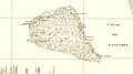
Placer de los Roques-1854.jpg
1,107 × 615; 190 KB
 Placer de los Roques-1854.jpg 1,107 × 615; 190 KB