Category:1854 maps of New York (state)
States of the United States: California · Georgia · Illinois · Indiana · Iowa · Kentucky · Massachusetts · Michigan · Missouri · New York · Ohio · Oregon · Pennsylvania · Texas · Wisconsin
| ← 1850 1851 1852 1853 1854 1855 1856 1857 1858 1859 → |
Media in category "1854 maps of New York (state)"
The following 20 files are in this category, out of 20 total.
-
 1854 New York gubernatorial election results map by county.svg 810 × 621; 69 KB
-
 Chart of Piers At the Mouth of the Gennessee River, New York - NARA - 78117562.jpg 4,172 × 2,868; 412 KB
-
 Map of Albany County, New York - from actual surveys LOC 2012593645.jpg 16,705 × 11,558; 31.7 MB
-
 Map of Albany County, New York - from actual surveys LOC 2012593645.tif 16,705 × 11,558; 552.4 MB
-

-
 Map of Chautauque County, New York - from actual surveys LOC 2012593648.jpg 16,053 × 15,493; 38.92 MB
-
 Map of Erie County, New York - from actual surveys LOC 2012593657.jpg 12,571 × 16,942; 33.38 MB
-
 Map of Erie County, New York - from actual surveys LOC 2012593657.tif 12,571 × 16,942; 609.33 MB
-
 Map of Genesee County, New York - from actual surveys LOC 2013593273.jpg 15,669 × 11,108; 27.36 MB
-
 Map of Genesee County, New York - from actual surveys LOC 2013593273.tif 15,669 × 11,108; 497.96 MB
-
 Map of Putnam County, New-York LOC 2013593260.jpg 17,068 × 11,339; 25.84 MB
-
 Map of Rensselaer County, New York - from actual surveys LOC 2013593230.jpg 12,661 × 17,736; 38.09 MB
-
 Map of Rensselaer County, New York - from actual surveys LOC 2013593230.tif 12,661 × 17,736; 642.46 MB
-

-
 Map of the town of Niagara LOC 2013593243.jpg 9,458 × 7,900; 9.81 MB
-

-
-
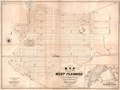
 Map of Ulster County, New York LOC 2001621181.jpg 16,517 × 12,411; 28.32 MB
-
 Map of Ulster County, New York LOC 2001621181.tif 16,517 × 12,411; 586.49 MB
-
 PlanOfDowntownBergen1854.jpg 798 × 679; 185 KB


.jpg)


.jpg)


