Category:1858 maps of Rhode Island
States of the United States: California · Connecticut · Illinois · Iowa · Louisiana · Massachusetts · Michigan · New York · Ohio · Pennsylvania · Rhode Island · Utah
| 1850 1851 1855 1858 |
Media in category "1858 maps of Rhode Island"
The following 2 files are in this category, out of 2 total.
-
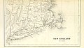 11 of 'History of New England. vol. 1-4' (11053875073).jpg 2,672 × 1,535; 1.01 MB
-
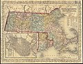 Map of Massachusetts and Rhode Island (8345827651).jpg 800 × 623; 169 KB
.jpg)
.jpg)