Category:1859 maps of California
States of the United States: California · Florida · Massachusetts · Michigan · New York · Oregon · Texas – Washington, D.C.
| ← 1850 1851 1852 1853 1854 1855 1856 1857 1858 1859 → |
Media in category "1859 maps of California"
The following 12 files are in this category, out of 12 total.
-
-
-

-

-

-
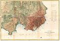
 From San Francisco Bay to the Plains of Los Angeles - from explorations and surveys LOC 98688426.jpg 10,750 × 8,739; 12.42 MB
-
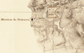
 Hb4v19n9kn-FID3.jpg 750 × 702; 80 KB
-

-

-
-
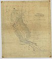 Map of the State of California - NARA - 23812146.jpg 9,280 × 10,554; 7.86 MB
-


.jpg)