Category:1860s maps of Central Asia
English: This category is intended to collect maps from the 1860s, showing Central Asia. (Note: This is preferred over subdividing the region according to current/modern borders, unless the map title or prominent labels name a specific modern or past country.)
| 19th-century maps of Central Asia: ← 1800s 1830s 1840s 1850s 1860s 1870s 1880s 1890s |
Subcategories
This category has only the following subcategory.
1
Media in category "1860s maps of Central Asia"
The following 13 files are in this category, out of 13 total.
-
 1860. Карта Киргизских Степей.jpg 6,000 × 4,683; 4.44 MB
-
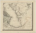
 Turkestan or Independent Tartary.jpg 6,611 × 4,606; 8.48 MB
-

-
-
 Le Tour du monde-07-p339.jpg 1,570 × 1,072; 415 KB
-
 Stein, Christ. Gottfr. Dan.West-Asien. 1865 C.jpg 1,536 × 1,351; 294 KB
-
 Stein, Christ. Gottfr. Dan.West-Asien. 1865 LD.jpg 1,861 × 1,670; 465 KB
-
 Stein, Christ. Gottfr. Dan.West-Asien. 1865 M.jpg 2,638 × 1,722; 726 KB
-
 Stein, Christ. Gottfr. Dan.West-Asien. 1865 N.jpg 2,539 × 1,487; 557 KB
-

-
 Zentralasien BV042517576.jpg 11,270 × 7,133; 8.33 MB
-
 PunjabTurkestan.jpg 5,680 × 5,608; 16.04 MB
-
 Ilin 186x Karta Syr Darinskoj oblast 72.jpg 1,820 × 1,411; 265 KB


.jpg)
.jpg)


.jpg)