Category:1860s maps of England
Media in category "1860s maps of England"
The following 14 files are in this category, out of 14 total.
-
-

-
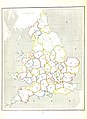
 JOHNSTON'S ROYAL ATLAS (1861), ENGLAND NORTHERN PART.jpg 8,910 × 6,868; 10.76 MB
-
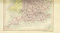
 JOHNSTON'S ROYAL ATLAS (1861), ENGLAND SOUTHERN PART.jpg 8,903 × 6,916; 11.21 MB
-
 1862 Johnson Map of England and Wales - Geographicus - England-johnson-1862.jpg 3,468 × 5,000; 6.27 MB
-

-

-
-

-
-

-

-
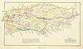
 Geological Map of Northumberland and Durham 1867.jpg 1,874 × 3,015; 1.67 MB
-
 John Henry Parker - The railway travellers walk through Oxford (1860) - 2.tif 7,016 × 4,631, 2 pages; 93 MB
.jpg)
.jpg)
,_ENGLAND_NORTHERN_PART.jpg)
,_ENGLAND_SOUTHERN_PART.jpg)


%27_(11073713915).jpg)
%27_(11072630923).jpg)
_(By_Edward_Viles.)%27_(11087069786).jpg)
%27_(11059186845).jpg)
%27_(11086046844).jpg)
%27_(11059395156).jpg)
