Category:1862 maps of Asia
Temperate regions: North America · South America · Africa · Europe · Asia · Oceania – Polar regions: – Other regions:
English: 1862 maps of Asia
Español: Mapas de Asia en 1862
Subcategories
This category has the following 5 subcategories, out of 5 total.
.
C
- 1862 maps of China (3 F)
I
- 1862 maps of India (1 F)
- 1862 maps of Iran (4 F)
J
- 1862 maps of Japan (1 F)
Media in category "1862 maps of Asia"
The following 16 files are in this category, out of 16 total.
-
1862 Johnson Map of Asia - Geographicus - Asia-johnson-1862.jpg 3,000 × 2,433; 2.35 MB
-
1862 Perthes Map of Asia - Geographicus - AsienPoli-perthes-1862.jpg 3,192 × 2,641; 2.33 MB
-
1862 Perthes Physical Map of Asia - Geographicus - AsienPhy-perthes-1862.jpg 3,200 × 2,551; 2.1 MB
-
Asie 1862.jpg 5,965 × 3,835; 3.78 MB
-
Asie Meridionale 1862.jpg 3,835 × 3,073; 2.02 MB
-
Asie Orientale 1862.jpg 3,835 × 3,021; 2.07 MB
-
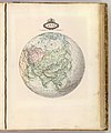
Asie spheroidale.jpg 3,196 × 3,835; 1.61 MB
-
Canton Map 1862.jpg 15,982 × 8,683; 12.75 MB
-
Edward Stanford Ltd, Palestine after the conquest (FL6878204 2369411).jpg 2,200 × 2,831; 2.75 MB
-
F.B. Christian, Sur ancient Tyre (FL167448649 2370046).jpg 12,199 × 16,315; 198.83 MB
-
Iles de la Sonde et Philippines 1862.jpg 3,835 × 3,060; 1.84 MB
-
Map of Persia, Turkey in Asia, Afghanistan, Beloochistan.jpg 8,815 × 7,143; 15.63 MB
-
Xizang quan tu. LOC 2006626293.jpg 10,809 × 5,576; 7.68 MB
-
Xizang quan tu. LOC 2006626293.tif 10,809 × 5,576; 172.44 MB
-
敦賀・琵琶湖間運河計画図(1867年) (cropped).png 1,432 × 719; 1.36 MB
-
敦賀・琵琶湖間運河計画図(1867年).png 1,703 × 868; 1.77 MB


