Category:1864 maps of Massachusetts
States of the United States: Alabama · California · Delaware · Florida · Georgia · Idaho · Illinois · Kentucky · Louisiana · Maryland · Massachusetts · Michigan · Mississippi · New Mexico · New York · North Carolina · Ohio · Oregon · Pennsylvania · South Carolina · Tennessee · Utah · Virginia · Washington · West Virginia – Washington, D.C.
Puerto Rico
Puerto Rico
| ← 1860 1861 1862 1863 1864 1865 1866 1867 1868 1869 → |
Media in category "1864 maps of Massachusetts"
The following 8 files are in this category, out of 8 total.
-
-

-
 1864 Mitchell Map of Boston, Massachusetts - Geographicus - Boston-mitchell-1864.jpg 2,964 × 3,548; 2.28 MB
-

-

-
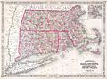
 Johnsons Massachusetts Connecticut and Rhode Island (7537856132).jpg 2,000 × 1,384; 3.12 MB
-

-

_-_Geographicus_-_VTNHMACTRI-j-64.jpg)


.jpg)
.jpg)
,_showing_the_system_of_streets,_grades_and_sewers_as_laid_out_and_recommended_by_the_Back_Bay_Commissioners_(3886417341).jpg)