Category:1870s maps of the Atlantic Ocean
Media in category "1870s maps of the Atlantic Ocean"
The following 23 files are in this category, out of 23 total.
-

-

-

-

-

-
-
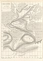
 FMIB 49367 Track of H M S "Porcupine" -- 1876.jpeg 2,112 × 1,608; 1.08 MB
-

-

-

-
-

-
 Admiralty Chart No 2060a North Atlantic Ocean Eastern portion, Published 1870.jpg 6,289 × 10,735; 24.15 MB
-
 Admiralty Chart No 2060b North Atlantic Ocean Western portion, Published 1870.jpg 11,811 × 14,173; 32.49 MB
-
 Admiralty Chart No 2202a South Atlantic Ocean Eastern portion, Published 1871.jpg 7,963 × 13,890; 34.94 MB
-
 Admiralty Chart No 2202b South Atlantic Ocean Western portion, Published 1871.jpg 7,623 × 13,415; 59.57 MB
-
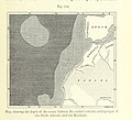
 Carpenter Porcupine 1870 Plate 4 proceedingsofroy1818roya 0527.jpg 2,508 × 3,540; 730 KB
-
 Carpenter Porcupine 1870 Plate 5 proceedingsofroy1818roya 0531.jpg 3,608 × 3,227; 551 KB
-
 Carpenter Porcupine 1870 Plate 6 proceedingsofroy1818roya 0535.jpg 5,163 × 3,390; 1.02 MB
-
 FMIB 43923 Trade-winds and Monsoons of the Atlantic.jpeg 865 × 702; 188 KB
-
 FMIB 43964 Transatlantic Cables.jpeg 887 × 461; 126 KB
-
 FMIB 43969 Showers of Volcanic Ashes.jpeg 2,147 × 1,545; 776 KB
-
 FMIB 49946 -Atlantic Ocean-.jpeg 1,113 × 701; 255 KB
.jpg)
.jpg)

.jpg)

.jpg)

_(14598194550).jpg)
%27_(11267992386).jpg)
.jpg)
%27_(11257784594).jpg)
%27_(11116221293).jpg)


