Category:1871 maps of Minnesota
States of the United States: California · Illinois · Iowa · Kentucky · Massachusetts · Michigan · Minnesota · New York · Ohio · Pennsylvania · Texas · Wyoming
| 1870 1871 |
Media in category "1871 maps of Minnesota"
The following 3 files are in this category, out of 3 total.
-
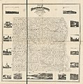 Map of Houston County, Minnesota LOC 2012593030.jpg 14,719 × 14,847; 32.01 MB
-
 Map of Houston County, Minnesota LOC 2012593030.tif 14,719 × 14,847; 625.23 MB
-
 Outline Map of Central Minnesota.png 3,617 × 2,396; 2.55 MB

