Category:1877 maps of France
Countries of Europe: France‡ · Georgia‡ · Germany · Italy · Norway · Russia‡ · Spain‡ · United Kingdom
‡: partly located in Europe
‡: partly located in Europe
Media in category "1877 maps of France"
The following 18 files are in this category, out of 18 total.
-

-

-
 1877 Vuillemin Folding Pocket Map of Paris, France - Geographicus - Paris-vuillemin-1877.jpg 5,962 × 4,136; 8.85 MB
-

-

-

-

-

-
-

-
 Kremer-et-Bouniol.svg 586 × 362; 15 KB
-
 Map- France at the Treaty of Bretigny (cropped).jpg 961 × 1,134; 302 KB
-
 Map- France at the Treaty of Bretigny.jpg 1,107 × 1,389; 384 KB
-
 Nouveau plan complet illustré de la ville de Paris en 1877 by Alexandre Vuillemin - Gallica.jpg 10,666 × 7,624; 18.97 MB
-
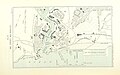
 Plan de la ville de Pont-à-Mousson - 1877.jpg 6,292 × 8,727; 8.56 MB
-
 Plan de la ville de Toul en 1876.jpg 8,600 × 6,775; 9.38 MB
-
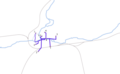
 Rennes 1877.svg 477 × 384; 37 KB
-

%27_(11119541854).jpg)
.jpg)

.jpg)
.jpg)
.jpg)
.jpg)
.jpg)
.jpg)
.jpg)

.jpg)


