Category:1877 maps of North America
Temperate regions: North America · South America · Africa · Europe · Asia · – Polar regions: – Other regions:
English: 1877 maps of North America
Subcategories
This category has the following 2 subcategories, out of 2 total.
C
U
Media in category "1877 maps of North America"
The following 19 files are in this category, out of 19 total.
-

-

-
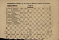 Nomenclatura de las calles de Mérida (Capital de Yucatán) 1877 - Plan 1.jpg 1,844 × 1,253; 1.11 MB
-
 Nomenclatura de las calles de Mérida (Capital de Yucatán) 1877 - Plan 2.jpg 1,778 × 1,256; 1.13 MB
-
 Stanford's library map of North America (NYPL b20760570-5437648).jpg 7,672 × 9,859; 46.76 MB
-
 Stanford's library map of North America (NYPL b20760570-5437648).tiff 7,760 × 10,328, 2 pages; 229.61 MB
-
 Stanford's library map of North America (NYPL b20760570-5437649).jpg 7,760 × 9,641; 59.35 MB
-
 Stanford's library map of North America (NYPL b20760570-5437649).tiff 7,760 × 10,328, 2 pages; 229.61 MB
-
 Stanford's library map of North America (NYPL b20760570-5437650).jpg 7,735 × 9,549; 58.15 MB
-
 Stanford's library map of North America (NYPL b20760570-5437650).tiff 7,760 × 10,328, 2 pages; 229.61 MB
-
 Stanford's library map of North America (NYPL b20760570-5437651).jpg 7,760 × 9,731; 64 MB
-
 Stanford's library map of North America (NYPL b20760570-5437652) (cropped).tiff 3,116 × 3,414; 20.02 MB
-
 Stanford's library map of North America (NYPL b20760570-5437652).tiff 15,621 × 18,477; 826.05 MB
-
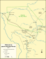 Outbreak of the Nez Perce War-fr.svg 895 × 1,150; 123 KB
-
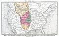 Plate II The locust plague in the United States (1877).jpg 1,300 × 811; 526 KB
-
 Plate III The locust plague in the United States (1877).jpg 1,298 × 834; 515 KB
-

-

-

.jpg)

_1877_-_Plan_1.jpg)
_1877_-_Plan_2.jpg)
.jpg)
.jpg)
.jpg)
.jpg)

.jpg)
.jpg)
_-_the_game_animals,_birds_and_fishes_of_North_America_-_their_habits_and_various_methods_of_capture_-_copious_instructions_in_shooting,_fishing,_(20424802310).jpg)
_-_the_game_animals,_birds_and_fishes_of_North_America_-_their_habits_and_various_methods_of_capture_-_copious_instructions_in_shooting,_fishing,_(20424806400).jpg)
_-_the_game_animals,_birds_and_fishes_of_North_America_-_their_habits_and_various_methods_of_capture_-_copious_instructions_in_shooting,_fishing,_(20586491846).jpg)