Category:1877 survey marker 48
|
This is a category about a place or building that is listed on the National Register of Historic Places in the United States of America. Its reference number is 76000448. |
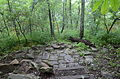
historic boundary marker on the state line between Arkansas and Oklahoma  | |||||
| Upload media | |||||
| Instance of | |||||
|---|---|---|---|---|---|
| Location | |||||
| Heritage designation |
| ||||
| Point in time |
| ||||
 | |||||
Media in category "1877 survey marker 48"
The following 3 files are in this category, out of 3 total.
-
 State Line Marker, 1 of 3.JPG 4,928 × 3,264; 7.83 MB
-
 State Line Marker, 2 of 3.JPG 4,928 × 3,264; 7.95 MB
-
 State Line Marker, 3 of 3.JPG 4,928 × 3,264; 11.19 MB

