Category:1878 maps of Europe
Temperate regions: North America · South America · Africa · Europe · Asia · – Polar regions: – Other regions:
English: 1878 maps of Europe
Español: Mapas de Europa en 1878
Suomi: Euroopan kartat vuodelta 1878
Română: Hărți ale Europei din 1878
Subcategories
This category has the following 7 subcategories, out of 7 total.
.
F
G
I
- 1878 maps of Italy (3 F)
N
- 1878 maps of Norway (1 F)
S
- 1878 maps of Spain (3 F)
- 1878 maps of Switzerland (4 F)
Media in category "1878 maps of Europe"
The following 13 files are in this category, out of 13 total.
-

-

-

-

-

-
 6 of 'India and her Neighbours ... With maps and appendix' (11122122656).jpg 5,496 × 4,070; 5.45 MB
-
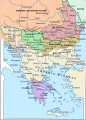 Balkans 1878-es.svg 4,120 × 5,720; 1.05 MB
-
 EB9 Denmark-1878.png 2,811 × 3,870; 11 MB
-
 EB9 Denmark.png 2,821 × 4,000; 16.19 MB
-
 Nouvelle carte d'Europe physique et routière - dressée par Charle... - btv1b530931582.jpg 10,807 × 7,625; 17.77 MB
-
 Papagallo no 15 la piovra russa anno VI LCCN2003688829.jpg 9,496 × 6,832; 13.52 MB
-
 Sanstefanska Bulgaria.png 3,791 × 2,647; 1.9 MB
-
 The Collegiate Atlas 1876 (73060536).jpg 6,752 × 5,240; 5.24 MB
.jpg)
.jpg)
.jpg)
%27_(11087942406).jpg)
%27_(11121136726).jpg)
.jpg)


.jpg)