Category:1880 maps of Asia
Temperate regions: North America · South America · Africa · Europe · Asia · – Polar regions: – Other regions:
English: 1880 maps of Asia
Español: Mapas de Asia en 1880
Subcategories
This category has the following 8 subcategories, out of 8 total.
.
A
- 1880 maps of Afghanistan (8 F)
- 1880 maps of Azerbaijan (2 F)
C
G
- 1880 maps of Georgia (2 F)
I
- 1880 maps of India (13 F)
P
- 1880 maps of Pakistan (2 F)
R
Media in category "1880 maps of Asia"
The following 10 files are in this category, out of 10 total.
-
 1880s Meiji Japanese Folding Map of Japan - Geographicus - Japan-meiji-1880.jpg 3,580 × 5,000; 5.56 MB
-
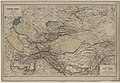 Central-Asien 1880 map by Joseph Chavanne.jpg 10,813 × 7,440; 11.6 MB
-
 Itinéraires en Océanie - par le dr Montano, 1880-1881 - btv1b55010872t.jpg 4,569 × 3,430; 1.95 MB
-
 Karte von Central-Asien nach den neuesten Quellen bearbeitet von Dr. Joseph Chavanne.jpg 9,943 × 6,416; 23.42 MB
-

-
 Map of eastern China, Japan, and Korea. LOC 2006458330.jpg 3,862 × 3,355; 1.77 MB
-
 Map of eastern China, Japan, and Korea. LOC 2006458330.tif 3,862 × 3,355; 37.07 MB
-

-
 Philippine territorial map 1880 MINDANAO.PNG 674 × 676; 817 KB
-
 Philippine territorial map 1880.PNG 1,394 × 2,052; 4.75 MB


_with_parts_of_Tibet,_India_and_Nepal,_from-_Stanford%27s_map_of_the_empires_of_China_and_Japan_with_the_adjacent_parts_of_the_Russian_Empire,_India,_Burma_etc._LOC_2006458442_(cropped).jpg)

.jpg)

