Category:1880s maps of Mexico
Countries of the Americas: Argentina · The Bahamas · Belize · Bolivia · Brazil · Canada · Chile · Colombia · Costa Rica · Cuba · Ecuador · Guatemala · Haiti · Jamaica · Mexico · Panama · Paraguay · Peru · Saint Kitts and Nevis · United States of America · Uruguay · Venezuela
Other areas: Aruba · Puerto Rico
Other areas: Aruba · Puerto Rico
Subcategories
This category has the following 5 subcategories, out of 5 total.
- 1881 maps of Mexico (3 F)
- 1883 maps of Mexico (5 F)
- 1888 maps of Mexico (6 F)
Media in category "1880s maps of Mexico"
The following 20 files are in this category, out of 20 total.
-
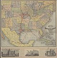 Rand, McNally and Co. Map of the Houston and Texas Central Railway 1880 UTA.jpg 8,476 × 8,528; 11.04 MB
-

-

-
 192 of 'About Mexico, past and present ... With ... maps, etc' (11287886275).jpg 1,211 × 1,351; 487 KB
-
 210 of 'About Mexico, past and present ... With ... maps, etc' (11287972254).jpg 1,208 × 1,350; 480 KB
-
 AMPP D142 Early discoveries in New Spain.jpg 1,621 × 1,134; 339 KB
-
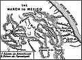 AMPP D162 The march to Mexico.jpg 1,545 × 1,134; 509 KB
-
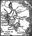 AMPP D194 The valley of Mexico.jpg 1,604 × 1,797; 789 KB
-
 AMPP D212 The valley of Mexico.jpg 1,627 × 1,828; 821 KB
-
 TSOM D031 Map of Mexico part 1.png 3,605 × 2,394; 569 KB
-
-
 Frontiers of Mexico, in Old Mexico and her lost provinces (1883) (14594618579).jpg 2,144 × 1,792; 591 KB
-

-
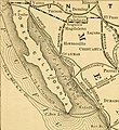
 Map of South West.jpg 598 × 600; 142 KB
-
 Map of the mexican central railway and connections... - btv1b53023094c (1 of 2).jpg 7,697 × 6,401; 9.22 MB
-
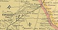 Map-of-Zaragoza-Coahuila-México.jpg 1,037 × 546; 485 KB
-
 Meyers b11 s0559a.jpg 2,048 × 1,694; 705 KB
-
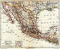
 Nuevo mapa de Mexico (14959052581).jpg 2,000 × 1,474; 3.04 MB
-
 Spruner-Menke Handatlas 1880 Karte 20.jpg 10,433 × 8,737; 16.46 MB
-
 The Santa Fé Route and connections, 1888. LOC 98688797.jpg 7,609 × 4,847; 7.45 MB

.jpg)
.jpg)
.jpg)
.jpg)


_(14594814447)_(cropped).jpg)
_(14594618579).jpg)
.jpg)

.jpg)


.jpg)

