Category:1881 maps of Africa
Temperate regions: North America · South America · Africa · Europe · Asia · – Polar regions: – Other regions:
| ← 1880 1881 1882 1883 1884 1885 1886 1887 1888 1889 → |
Subcategories
This category has only the following subcategory.
A
Media in category "1881 maps of Africa"
The following 39 files are in this category, out of 39 total.
-
-
 Andree96-1.jpg 1,990 × 2,535; 4.79 MB
-

-
 A map of eastern equatorial Africa LOC 2009578548-16.tif 9,591 × 9,795; 268.78 MB
-
 Afrika - DPLA - d4fa1a46d5b6335c7dfc996bc5dc1797.jpg 1,000 × 809; 207 KB
-
 Afrique physique (2e édition) - dressée et dessinée par J.-V. Barbier... - btv1b8458474m.jpg 9,722 × 8,474; 11.56 MB
-
 Archives des missions scientifiques et littéraires (1881) (19758062921).jpg 4,776 × 2,568; 2 MB
-
 Cameron - A travers l'Afrique 1881 - Carte-1.jpg 11,935 × 4,709; 7.34 MB
-
 Cameron - A travers l'Afrique 1881 - Carte-2.jpg 13,400 × 990; 2.12 MB
-
 Cameron - A travers l'Afrique 1881 - Carte.jpg 13,788 × 6,496; 10.55 MB
-

-

-
 Carte de l'Algérie et de la Tunisie - gravée par L. Sonnet - btv1b53081303h.jpg 7,578 × 5,249; 7.15 MB
-

-

-

-

-

-
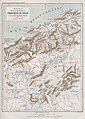
 General Map of South Africa - DPLA - 442239c7b7713ad1ce99d1544ce3ba6e.jpg 1,000 × 864; 273 KB
-

-
 Itinéraire à Timbouktou par le Dr. Oscar Lenz 1880 (1881).jpg 2,398 × 3,500; 10.48 MB
-
-

-

-

-
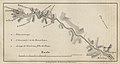
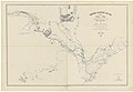
 Route through Northern Ugogo - DPLA - 67179e8225345155053c0bb71d798c84.jpg 1,000 × 559; 174 KB
-

-

-

-

-
 Senegambien - DPLA - 53134623e544d0964307a7a4831086f2.jpg 762 × 1,000; 263 KB
-
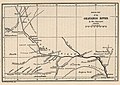 Sketch Map of the Okavango River - DPLA - f0e2dfbfe7db2ede5934b3359b9c3905.jpg 1,000 × 708; 185 KB
-

-

-

-
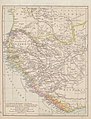
 Süd-Afrika - DPLA - f46d3f2c16fdd0a1f966bfbb52ad6024.jpg 1,000 × 744; 274 KB
-
-

-

_-_DPLA_-_a909aba677933da0cdd29bedbf33ed0b.jpg)


_-_dress%C3%A9e_et_dessin%C3%A9e_par_J.-V._Barbier..._-_btv1b8458474m.jpg)
_(19758062921).jpg)


.jpg)
.jpg)


.jpg)