Category:1884 maps of Boston
Media in category "1884 maps of Boston"
The following 22 files are in this category, out of 22 total.
-
 1884 topographical map of West Roxbury Park.jpg 10,224 × 7,214; 7.85 MB
-
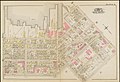
 Atlas of the city of Boston - South and East Boston - plate A (19236881734).jpg 2,000 × 1,372; 2.89 MB
-
 Atlas of the city of Boston - South and East Boston - plate B (19672944449).jpg 2,000 × 1,370; 3.19 MB
-
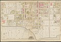
 Atlas of the city of Boston - South and East Boston - plate C (19238623693).jpg 2,000 × 1,374; 2.54 MB
-
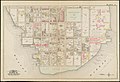
 Atlas of the city of Boston - South and East Boston - plate D (19852129602).jpg 2,000 × 1,374; 2.66 MB
-
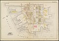
 Atlas of the city of Boston - South and East Boston - plate E (19859544995).jpg 2,000 × 1,372; 2.89 MB
-
 Atlas of the city of Boston - South and East Boston - plate F (19852130492).jpg 2,000 × 1,375; 2.96 MB
-
 Atlas of the city of Boston - South and East Boston - plate G (19859545755).jpg 2,000 × 1,374; 2.96 MB
-
 Atlas of the city of Boston - South and East Boston - plate H (19833340236).jpg 2,000 × 1,375; 2.67 MB
-
 Atlas of the city of Boston - South and East Boston - plate I (19671520880).jpg 2,000 × 1,376; 2.92 MB
-
 Atlas of the city of Boston - South and East Boston - plate J (19671521270).jpg 2,000 × 1,365; 2.83 MB
-
 Atlas of the city of Boston - South and East Boston - plate K (19671504858).jpg 2,000 × 1,376; 2.4 MB
-
 Atlas of the city of Boston - South and East Boston - plate L (19671521770).jpg 2,000 × 1,375; 2.63 MB
-
 Atlas of the city of Boston - South and East Boston - plate M (19672949119).jpg 2,000 × 1,378; 2.77 MB
-
 Atlas of the city of Boston - South and East Boston - plate N (19671522460).jpg 2,000 × 1,383; 3.01 MB
-
 Atlas of the city of Boston - South and East Boston - plate O (19238628673).jpg 2,000 × 1,380; 3 MB
-
 Atlas of the city of Boston - South and East Boston - plate P (19852134762).jpg 2,000 × 1,372; 3.2 MB
-
 Atlas of the city of Boston - South and East Boston - plate Q (19672950569).jpg 2,000 × 1,375; 2.82 MB
-
 Atlas of the city of Boston - South and East Boston - plate R (19671507178).jpg 2,000 × 1,377; 2.44 MB
-
 Eldridges new chart of Boston Harbor (3856246256).jpg 2,000 × 1,378; 2.51 MB
-

-
 Plan of Boston (7537855908).jpg 2,000 × 1,320; 2.45 MB

.jpg)
.jpg)
.jpg)
.jpg)
.jpg)
.jpg)
.jpg)
.jpg)
.jpg)
.jpg)
.jpg)
.jpg)
.jpg)
.jpg)
.jpg)
.jpg)
.jpg)
.jpg)
.jpg)
.jpg)
.jpg)