Category:1886 maps of Italy
Media in category "1886 maps of Italy"
The following 13 files are in this category, out of 13 total.
-
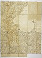 Carta topografica della riva sud – occidentale del lago di Garda, da Moniga a Sirmione.jpg 3,383 × 4,596; 13.21 MB
-
 Genoa 1886 - Italy handbook for travellers.jpg 2,460 × 2,169; 2.23 MB
-
 Genova - cinta muraria medioevale.jpg 589 × 361; 73 KB
-
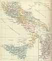 Italie du Sud Atlas de Carrez 1886.jpg 1,013 × 1,175; 637 KB
-
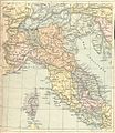 Italie Septentrionale Atlas de Carrez 1886.jpg 1,010 × 1,164; 748 KB
-
 Porto Genova 1886.png 904 × 1,386; 2.66 MB
-
 Roma Plan bw.jpg 1,840 × 1,463; 773 KB
-
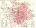 Roma Plan.jpg 1,840 × 1,463; 2.5 MB
-
 Roma PlanFXD.jpg 1,840 × 1,463; 1.06 MB
-
 Stazione Brignole 1886.png 409 × 592; 525 KB
-
 Stazione Principe 1886.png 645 × 500; 757 KB
-
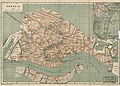 Venezia. LOC 2001620482.jpg 5,602 × 3,997; 3.85 MB
-
 Venezia. LOC 2001620482.tif 5,602 × 3,997; 64.06 MB


