Category:1888 maps of India
| ← 1880 1881 1882 1883 1884 1885 1886 1887 1888 → |
English: 1888 maps made in India or from India or showing history of India
Media in category "1888 maps of India"
The following 6 files are in this category, out of 6 total.
-
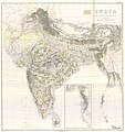
1888 India--second edition by Survey of India.jpg 20,142 × 21,316; 26.64 MB
-
Image taken from page 78 of 'Longmans' Junior School Geography, etc' (15968066584).jpg 1,789 × 2,399; 678 KB
-
Situationsplan von Bombay (Mumbai).jpg 349 × 503; 65 KB
-
Situationsplan von Kalkutta (Kolkata).jpg 344 × 520; 83 KB
-
Situationsplan von Madras (Chennai).jpg 349 × 468; 74 KB


