Home
Random
Nearby
Log in
Settings
Donate
About Wikimedia Commons
Disclaimers
Search
Category
:
1890 Sanborn Fire Insurance Map from Spokane, Spokane County, Washington
Language
Watch
Edit
Media in category "1890 Sanborn Fire Insurance Map from Spokane, Spokane County, Washington"
The following 28 files are in this category, out of 28 total.
Sanborn Fire Insurance Map from Spokane, Spokane County, Washington. LOC sanborn09331 004-1.jpg
6,450 × 7,650; 4.86 MB
Sanborn Fire Insurance Map from Spokane, Spokane County, Washington. LOC sanborn09331 004-10.jpg
6,450 × 7,650; 3.2 MB
Sanborn Fire Insurance Map from Spokane, Spokane County, Washington. LOC sanborn09331 004-11.jpg
6,450 × 7,650; 3.39 MB
Sanborn Fire Insurance Map from Spokane, Spokane County, Washington. LOC sanborn09331 004-12.jpg
6,450 × 7,650; 3.25 MB
Sanborn Fire Insurance Map from Spokane, Spokane County, Washington. LOC sanborn09331 004-13.jpg
6,450 × 7,650; 3.09 MB
Sanborn Fire Insurance Map from Spokane, Spokane County, Washington. LOC sanborn09331 004-14.jpg
6,450 × 7,650; 3.17 MB
Sanborn Fire Insurance Map from Spokane, Spokane County, Washington. LOC sanborn09331 004-15.jpg
6,450 × 7,650; 3.25 MB
Sanborn Fire Insurance Map from Spokane, Spokane County, Washington. LOC sanborn09331 004-16.jpg
6,450 × 7,650; 3.26 MB
Sanborn Fire Insurance Map from Spokane, Spokane County, Washington. LOC sanborn09331 004-17.jpg
6,450 × 7,650; 2.89 MB
Sanborn Fire Insurance Map from Spokane, Spokane County, Washington. LOC sanborn09331 004-18.jpg
6,450 × 7,650; 2.74 MB
Sanborn Fire Insurance Map from Spokane, Spokane County, Washington. LOC sanborn09331 004-19.jpg
6,450 × 7,650; 3 MB
Sanborn Fire Insurance Map from Spokane, Spokane County, Washington. LOC sanborn09331 004-2.jpg
6,450 × 7,650; 3.41 MB
Sanborn Fire Insurance Map from Spokane, Spokane County, Washington. LOC sanborn09331 004-20.jpg
6,450 × 7,650; 2.89 MB
Sanborn Fire Insurance Map from Spokane, Spokane County, Washington. LOC sanborn09331 004-21.jpg
6,450 × 7,650; 2.75 MB
Sanborn Fire Insurance Map from Spokane, Spokane County, Washington. LOC sanborn09331 004-22.jpg
6,450 × 7,650; 3.15 MB
Sanborn Fire Insurance Map from Spokane, Spokane County, Washington. LOC sanborn09331 004-23.jpg
6,450 × 7,650; 2.84 MB
Sanborn Fire Insurance Map from Spokane, Spokane County, Washington. LOC sanborn09331 004-24.jpg
6,450 × 7,650; 3.25 MB
Sanborn Fire Insurance Map from Spokane, Spokane County, Washington. LOC sanborn09331 004-25.jpg
6,450 × 7,650; 2.88 MB
Sanborn Fire Insurance Map from Spokane, Spokane County, Washington. LOC sanborn09331 004-26.jpg
6,450 × 7,650; 2.87 MB
Sanborn Fire Insurance Map from Spokane, Spokane County, Washington. LOC sanborn09331 004-3.jpg
6,450 × 7,650; 3.28 MB
Sanborn Fire Insurance Map from Spokane, Spokane County, Washington. LOC sanborn09331 004-4.jpg
6,450 × 7,650; 3.49 MB
Sanborn Fire Insurance Map from Spokane, Spokane County, Washington. LOC sanborn09331 004-5.jpg
6,450 × 7,650; 3.27 MB
Sanborn Fire Insurance Map from Spokane, Spokane County, Washington. LOC sanborn09331 004-6.jpg
6,450 × 7,650; 3.45 MB
Sanborn Fire Insurance Map from Spokane, Spokane County, Washington. LOC sanborn09331 004-7.jpg
6,450 × 7,650; 3.44 MB
Sanborn Fire Insurance Map from Spokane, Spokane County, Washington. LOC sanborn09331 004-8.jpg
6,450 × 7,650; 3.61 MB
Sanborn Fire Insurance Map from Spokane, Spokane County, Washington. LOC sanborn09331 004-9.jpg
6,450 × 7,650; 3.76 MB
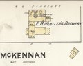
“E. A. Mueller’s Brewery” 1890 map - Sanborn Fire Insurance Map from Spokane, Spokane County, Washington. LOC sanborn09331 004-17 (cropped).tif
1,128 × 903; 2.91 MB
“New York Brewery” “Rudolph Gorkow” (capacity 30 barrels each brew) 1890 map - Sanborn Fire Insurance Map from Spokane, Spokane County, Washington. LOC sanborn09331 004-5 (cropped).tif
2,278 × 1,824; 11.89 MB