Category:1890s maps of Asia
Temperate regions: North America · South America · Africa · Europe · Asia · Oceania – Polar regions: – Other regions:
Subcategories
This category has the following 39 subcategories, out of 39 total.
.
1
- 1890s maps of Arabia (10 F)
A
- 1890s maps of Azerbaijan (5 F)
C
- 1890s maps of Cyprus (6 F)
E
G
I
J
- 1890s maps of Jordan (2 F)
L
- 1890s maps of Lebanon (empty)
M
- 1890s maps of Myanmar (8 F)
N
- 1890s maps of the Near East (9 F)
P
R
S
- 1890s maps of Syria (4 F)
T
- 1890s maps of the Philippines (27 F)
Media in category "1890s maps of Asia"
The following 3 files are in this category, out of 3 total.
-
 'César Cascabel' by George Roux 39.jpg 1,098 × 1,529; 615 KB
-
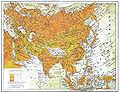 Brockhaus and Efron Encyclopedic Dictionary b2 955-1.jpg 3,333 × 2,552; 4.06 MB
-
 Brockhaus and Efron Encyclopedic Dictionary b2 955-2.jpg 3,332 × 2,552; 4.56 MB


