Category:1890s maps of Portugal
Countries of Europe: Albania · Armenia‡ · Austria · Azerbaijan‡ · Belarus · Belgium · Bosnia and Herzegovina · Bulgaria · Croatia · Cyprus‡ · Czech Republic · Denmark · Estonia · Finland · France‡ · Georgia‡ · Germany · Greece · Hungary · Republic of Ireland · Italy · Latvia · Lithuania · Montenegro · Netherlands‡ · Norway · Poland · Portugal‡ · Romania · Russia‡ · Serbia · Slovakia · Slovenia · Spain‡ · Sweden · Switzerland · Turkey‡ · Ukraine · United Kingdom
Limited recognition: Abkhazia‡
‡: partly located in Europe
Limited recognition: Abkhazia‡
‡: partly located in Europe
Media in category "1890s maps of Portugal"
The following 27 files are in this category, out of 27 total.
-
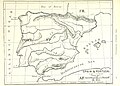
 126 of 'Chambers's New Geographical Readers' (11214172694).jpg 1,680 × 1,232; 529 KB
-
 64 of '(Longmans' Junior School Geography, etc.)' (11213766776).jpg 2,704 × 2,001; 1.11 MB
-
 64 of 'Longmans' Junior School Geography, etc' (11195932623).jpg 2,752 × 1,969; 1,008 KB
-
 65 of '(Longmans' Junior School Geography, etc.)' (11209350574).jpg 2,704 × 2,001; 1.07 MB
-
 65 of 'Longmans' Junior School Geography, etc' (11195544483).jpg 2,752 × 1,969; 986 KB
-
 Stielers Handatlas 1891 33.jpg 5,200 × 4,300; 7.84 MB
-
 Stielers Handatlas 1891 34.jpg 5,100 × 4,250; 7.12 MB
-
 Stielers Handatlas 1891 35.jpg 5,100 × 4,250; 6.85 MB
-
 Stielers Handatlas 1891 36.jpg 5,100 × 4,250; 5.35 MB
-

-

-
 40 of 'Arnold's Geographical Handbooks' (11288295206).jpg 1,226 × 1,321; 475 KB
-

-

-
 Azores or Western Islands, Cap. A.E.T. Vidal, RN, Londres, edição de 1896 - Image 209029.jpg 1,579 × 1,080; 1.75 MB
-
 Brockhaus and Efron Encyclopedic Dictionary b25 400-0.jpg 3,379 × 2,552; 2.95 MB
-
 Brockhaus' Konversations-Lexikon (1892) (14597764969).jpg 1,643 × 2,630; 811 KB
-

-
-
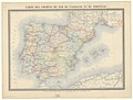
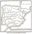 FERNANLD(1898) SPAIN in the 12th. & 13th. Cent..jpg 881 × 926; 416 KB
-

-
 Kingdom of Portugal (1890).svg 450 × 456; 422 KB
-
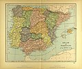 Map of Spain.jpg 3,506 × 2,931; 2.7 MB
-
 Mapa de España y Portugal... 1-1 600 000... - por Elias Zerolo - btv1b530297335 (1 of 2).jpg 10,381 × 8,456; 17.75 MB
-

-

-
 Stielers Handatlas 1891 32.jpg 4,650 × 4,050; 5.63 MB
.jpg)
%27_(11213766776).jpg)
.jpg)
%27_(11209350574).jpg)
.jpg)


.jpg)
_(14589934730).jpg)
.jpg)
.jpg)
.jpg)


_(14597764969).jpg)


_SPAIN_in_the_12th._%26_13th._Cent..jpg)
.jpg)
.svg)

.jpg)

.jpg)
