Category:1890s maps of the Balkans
English: This category is intended to collect maps from the 1890s that show multiple Balkan countries in one map frame.
| 19th-century maps of the Balkans: ← 1800s 1810s 1820s 1830s 1840s 1850s 1860s 1870s 1880s 1890s → |
Subcategories
This category has the following 6 subcategories, out of 6 total.
B
- 1890s maps of Bulgaria (4 F)
C
- 1890s maps of Croatia (15 F)
M
- 1890s maps of Montenegro (2 F)
R
S
- 1890s maps of Serbia (6 F)
Media in category "1890s maps of the Balkans"
The following 22 files are in this category, out of 22 total.
-

-
 Review of reviews and world's work (1890) (14770311371).jpg 2,738 × 2,188; 916 KB
-
 1890 map of Turkey in Europe in Ottoman Turkish.jpg 19,650 × 13,696; 126.24 MB
-
 Stielers Handatlas 1891 53.jpg 4,200 × 5,150; 6.92 MB
-
 Sandschak Novi Pazar BV044855591.jpg 5,000 × 4,052; 1.9 MB
-
 Meyers leiner Hand-atlas 1893 (73136902).jpg 6,352 × 9,572; 10.63 MB
-
 Meyers leiner Hand-atlas 1893 (73136916).jpg 9,551 × 6,397; 12.38 MB
-
 Meyers leiner Hand-atlas 1893 (73136928).jpg 9,533 × 6,385; 11.76 MB
-
 Ottův slovník naučný - 36 Dalmacie, Bosna a Hercegovina.jpg 2,311 × 1,940; 3.35 MB
-

-
 Bosnia-Herzegovina Dalmatia Serbia Montenegro by G. Marinelli.jpg 2,864 × 2,002; 1.95 MB
-
 États danubiens (1898).JPG 5,226 × 3,852; 7.08 MB
-

-
 Balkan states 1899.jpg 937 × 1,417; 305 KB
-
 Fuhrer durch Dalmatien 1899 (152906461).jpg 4,622 × 3,759; 9.34 MB
-
 Romanian Schools for Aromanians and Meglenoromanians.JPG 2,907 × 2,214; 1.15 MB
-
 Ethnographic map of the South Balkans, Pallas Nagy Lexikon, 1897.jpg 613 × 791; 580 KB
-
 Greece ethnic 1897.JPG 2,268 × 2,358; 901 KB
-
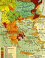
 Southwestern Balkans 1890.JPG 2,985 × 2,124; 2.47 MB
-
 Stielers Handatlas 1891 50.jpg 5,000 × 4,250; 6.61 MB
-
 Stielers Handatlas 1891 51.jpg 4,250 × 5,150; 8.02 MB
-
 Stielers Handatlas 1891 52.jpg 4,250 × 5,150; 7.13 MB
_oszt%C3%A1ly_sz%C3%A1mara._(With_maps.)%27_(11203814735).jpg)
_(14770311371).jpg)


.jpg)
.jpg)
.jpg)

._Traduit_de_l%27allemand,_avec_l%27autorisation_de_l%27auteur_et_annot%C3%A9e_sous_la_direction_de_Emm._de_Margerie._Avec_une_pr%C3%A9f._par_Marcel_Bertrand_(1897)_(14591563117).jpg)

.JPG)
.jpg)

.jpg)


