Category:1893 maps of France
Countries of Europe: France‡ · Germany · Italy · Norway · Russia‡ · Spain‡ · Switzerland · United Kingdom
‡: partly located in Europe
‡: partly located in Europe
Subcategories
This category has only the following subcategory.
Media in category "1893 maps of France"
The following 9 files are in this category, out of 9 total.
-

-

-
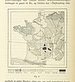
 59 of 'Leerboek der Aardsrijkskunde. Met Schetskaartjes, etc' (11303137184).jpg 1,417 × 1,426; 441 KB
-
-

-
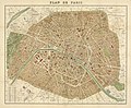 Plan de Paris by Alexandre Vuillemin, 1893 - Penn State University Libraries.jpg 14,507 × 11,957; 28.67 MB
-
 Stations de sauvetage sur les côtes de France - Corse, Algérie, Tunisie - btv1b531464026.jpg 6,030 × 8,130; 6.19 MB
-
 Meyers leiner Hand-atlas 1893 (73136860).jpg 6,368 × 9,568; 11.62 MB
-
 Meyers leiner Hand-atlas 1893 (73136874).jpg 9,567 × 6,368; 11.77 MB
.jpg)
.jpg)
.jpg)
.jpg)
_-_btv1b530291009.jpg)


.jpg)
.jpg)