Category:1895 Sanborn Fire Insurance Map from Bay City, Bay County, Michigan

|
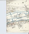
This map is available from the United States Library of Congress's Geography & Map Division
under the digital ID g4114bm.g039211895. This tag does not indicate the copyright status of the attached work. A normal copyright tag is still required. See Commons:Licensing.
|
Media in category "1895 Sanborn Fire Insurance Map from Bay City, Bay County, Michigan"
The following 7 files are in this category, out of 7 total.
-

-
 Sanborn Fire Insurance Map from Bay City, Bay County, Michigan. LOC sanborn03921 001-2.jpg 6,510 × 7,707; 3.55 MB
-
 Sanborn Fire Insurance Map from Bay City, Bay County, Michigan. LOC sanborn03921 001-3.jpg 6,510 × 7,707; 3.04 MB
-
 Sanborn Fire Insurance Map from Bay City, Bay County, Michigan. LOC sanborn03921 001-4.jpg 6,510 × 7,707; 3.26 MB
-
 Sanborn Fire Insurance Map from Bay City, Bay County, Michigan. LOC sanborn03921 001-5.jpg 6,510 × 7,707; 2.89 MB
-
 Sanborn Fire Insurance Map from Bay City, Bay County, Michigan. LOC sanborn03921 001-6.jpg 6,510 × 7,707; 3.05 MB
-
 Sanborn Fire Insurance Map from Bay City, Bay County, Michigan. LOC sanborn03921 001-7.jpg 6,510 × 7,707; 2.92 MB


