Category:1898 maps of England
Media in category "1898 maps of England"
The following 24 files are in this category, out of 24 total.
-
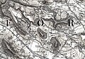
 161 of 'Chambers's Alternative Geography Readers. Standard IV.(-VII.)' (11293494923).jpg 1,137 × 1,046; 273 KB
-
-

-
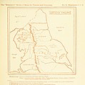
 Foxley Yazor Sheet 198 - Hereford Ordnance Survey One-Inch, England and Wales 1898.jpg 1,654 × 1,059; 1.41 MB
-
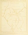
 King's Pyon, Herefordshire, OS Map Sheet 198 - Hereford (Hills) 1898.jpg 540 × 496; 412 KB
-
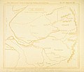
 Newton, Hampton Court Herefordshire, OS Map Sheet 198 - Hereford (Hills) 1898.jpg 1,221 × 870; 1.36 MB
-

-
 19 of 'The “Beaumont” Geography and Map Tracing Book' (11247014584).jpg 1,970 × 1,995; 728 KB
-

-
 21 of 'The “Beaumont” Geography and Map Tracing Book' (11245673235).jpg 1,970 × 1,987; 717 KB
-
 27 of 'The “Beaumont” Geography and Map Tracing Book' (11247367936).jpg 1,970 × 1,995; 667 KB
-

-
 57 of 'The “Beaumont” Geography and Map Tracing Book' (11248289386).jpg 1,965 × 2,537; 962 KB
-
 61 of 'The “Beaumont” Geography and Map Tracing Book' (11247897876).jpg 1,970 × 2,440; 938 KB
-
 63 of 'The “Beaumont” Geography and Map Tracing Book' (11246551965).jpg 1,970 × 2,440; 938 KB
-
 67 of 'The “Beaumont” Geography and Map Tracing Book' (11245577935).jpg 2,368 × 2,131; 991 KB
-
 69 of 'The “Beaumont” Geography and Map Tracing Book' (11247723584).jpg 2,368 × 2,134; 1,002 KB
-
 73 of 'The “Beaumont” Geography and Map Tracing Book' (11247408165).jpg 1,970 × 2,440; 957 KB
-
 75 of 'The “Beaumont” Geography and Map Tracing Book' (11244984123).jpg 2,432 × 2,108; 1,024 KB
-
 77 of 'The “Beaumont” Geography and Map Tracing Book' (11247206703).jpg 2,148 × 2,440; 1.07 MB
-
 79 of 'The “Beaumont” Geography and Map Tracing Book' (11246815234).jpg 2,432 × 2,158; 994 KB
-

-
 99 of 'The “Beaumont” Geography and Map Tracing Book' (11248260856).jpg 1,968 × 2,484; 918 KB
-
 PITMAN(1898) p141 - The Potteries and Black Country.jpg 1,312 × 1,942; 438 KB
%27_(11293494923).jpg)

_1898.jpg)

_1898.jpg)
_1898.jpg)
_1898.jpg)
.jpg)
.jpg)
.jpg)
.jpg)
%27_(11294079763).jpg)
.jpg)
.jpg)
.jpg)
.jpg)
.jpg)
.jpg)
.jpg)
.jpg)
.jpg)
%27_(11248296173).jpg)
.jpg)
_p141_-_The_Potteries_and_Black_Country.jpg)