Category:18th-century maps of Ain
Subcategories
This category has only the following subcategory.
Media in category "18th-century maps of Ain"
The following 5 files are in this category, out of 5 total.
-
 Carte du département de l'Ain - 1790-1793.tif 5,733 × 5,611; 92.08 MB
-
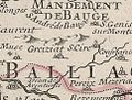 Carte Greiziat St Cyr Menthon Duché Bourgogne.jpg 484 × 368; 45 KB
-

-

-
 Atlas national portatif de la France 1792 (105093584).jpg 6,937 × 5,761; 6.34 MB


.jpg)