Category:18th-century maps of Bavaria
Federal states of Germany:
Subcategories
This category has the following 10 subcategories, out of 10 total.
- 1750s maps of Bavaria (8 F)
A
Media in category "18th-century maps of Bavaria"
The following 7 files are in this category, out of 7 total.
-
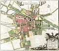 Ansbach.jpg 993 × 850; 188 KB
-
 Eigentliche Verzeichnung der Gegend und - Homann Johann btv1b5904162b.JPEG 1,336 × 1,054; 574 KB
-
 LASB K Hellwig 0376.jpg 7,575 × 6,300; 6.64 MB
-
 Insula in Lacu Acronio Superiore Lindaugiae.jpg 750 × 484; 113 KB
-
 Schlottenhof - Rittergut - Grundriss 1762 - Johann Georg Ullmann - 01.jpg 4,085 × 2,937; 9.66 MB
-
 Staffelsee Old Map.jpg 731 × 530; 103 KB
-
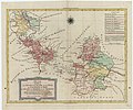
 Territory of Nuremberg.jpg 2,112 × 2,816; 1.96 MB


